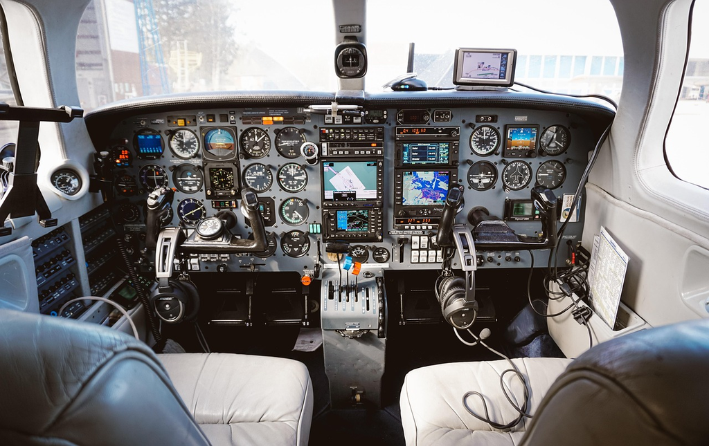
Airplane navigation systems are advanced technologies used to guide aircraft safely from one location to another. These systems include GPS, inertial navigation, and radio-based aids like VOR and ILS, ensuring precise route planning and real-time position tracking. They help pilots avoid obstacles, maintain proper altitude, and communicate with air traffic control. Compared to car navigation, airplane systems are more complex due to three-dimensional movement and strict safety requirements.
Airplane Navigation Systems
Airplane navigation systems are advanced technologies used to guide aircraft safely from one location to another. These systems include GPS, inertial navigation, and radio-based aids like VOR and ILS, ensuring precise route planning and real-time position tracking. They help pilots avoid obstacles, maintain proper altitude, and communicate with air traffic control. Compared to car navigation, airplane systems are more complex due to three-dimensional movement and strict safety requirements.
💡 Key Takeaways
- Identify the main navigation systems used in modern aircraft (GPS/GNSS, INS, VOR/DME, RNAV) and their roles.
- Explain how a flight management system (FMS) plans and follows routes using navigation data.
- Understand how pilots cross-check and switch between navigation sources to maintain accuracy.
- Describe common navigation data concepts (waypoints, airways, fixes) and how routes are structured.
- Recognize redundancy and basic failure-handling strategies for navigation systems (backup methods and reversion to primary sources).
❓ Frequently Asked Questions
What is an airplane navigation system?
A set of tools and sensors that determine the aircraft's position, track, and route. It combines satellite navigation (GNSS), inertial sensors, radio aids (like VOR/DME), and an onboard Flight Management System to guide the flight.
What is GPS/GNSS and how is it used in air navigation?
GNSS uses satellites to provide precise position and time. In aviation, GNSS data feeds the Flight Management System and autopilot to follow routes and update position, with accuracy boosted by ground augmentations (WAAS/EGNOS). If satellites are unavailable, other sensors help maintain navigation.
What is inertial navigation (INS/IRS) and why is it used?
An inertial navigation system uses accelerometers and gyroscopes to measure motion and compute position and attitude. It works without satellites but drifts over time, so it is usually combined with GNSS for accuracy and continuity.
What are RNAV/RNP and the Flight Management System (FMS) used for?
RNAV (and RNP) enable flying routes defined by waypoints using GNSS and onboard sensors, instead of fixed ground-based beacons. RNP adds performance and monitoring requirements. The FMS plans the route and provides commands to the autopilot to follow it, including approaches.