Floodplain basics refer to the fundamental characteristics of low-lying areas adjacent to rivers, which are naturally prone to periodic flooding. Riverine flooding occurs when rivers overflow their banks due to excessive rainfall, snowmelt, or upstream runoff. These floods can inundate floodplains, impacting ecosystems, agriculture, and human settlements. Understanding floodplain dynamics is essential for effective land use planning, flood risk management, and minimizing potential damage to communities and infrastructure.
Floodplain Basics and Riverine Flooding
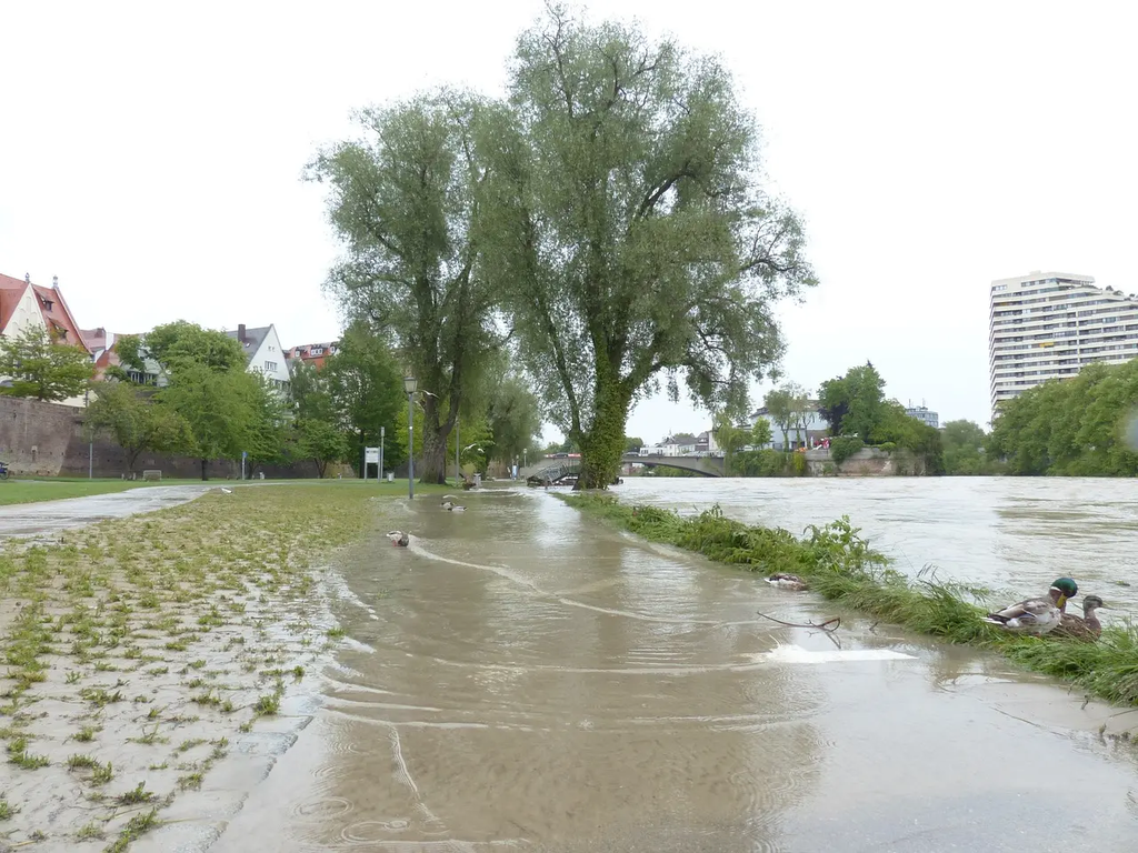
Floodplain basics refer to the fundamental characteristics of low-lying areas adjacent to rivers, which are naturally prone to periodic flooding. Riverine flooding occurs when rivers overflow their banks due to excessive rainfall, snowmelt, or upstream runoff. These floods can inundate floodplains, impacting ecosystems, agriculture, and human settlements. Understanding floodplain dynamics is essential for effective land use planning, flood risk management, and minimizing potential damage to communities and infrastructure.
💡 Key Takeaways
- Define floodplain and explain why floodplains are naturally prone to periodic flooding.
- Explain how riverine flooding occurs when rivers overflow their banks due to rainfall, snowmelt, or upstream runoff.
- List the factors that influence flood magnitude and frequency on floodplains (precipitation intensity, snowpack, upstream land use, dam releases).
- Describe the impacts of riverine floods on communities and ecosystems and the role of floodplains as natural flood buffers.
❓ Frequently Asked Questions
What is a floodplain?
A floodplain is the flat or gently sloped land next to a river that is periodically flooded when water levels rise, often forming wetlands and depositing sediment.
What causes riverine flooding?
Riverine flooding happens when a river overflows its banks due to heavy rainfall, snowmelt, or upstream runoff, raising water levels and inundating surrounding areas.
How do floodplains relate to flood risk?
Floodplains naturally store and slow floodwaters, helping protect downstream areas; development on floodplains can increase risk to people and property during floods.
What are common flood risk management strategies?
Strategies include avoiding development in floodplains, building levees or floodwalls, creating retention basins and floodways, and improving flood forecasting and early warning systems.