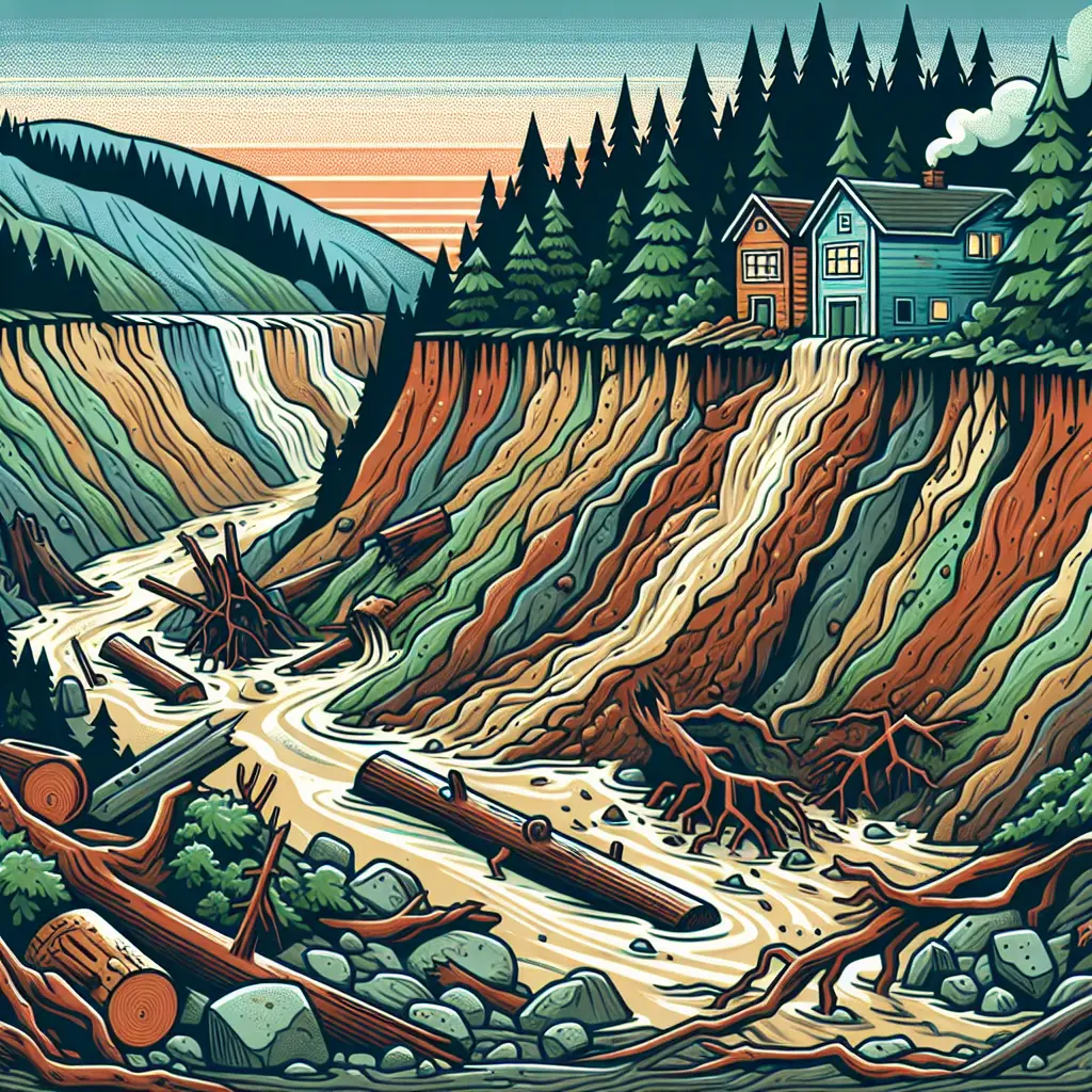
In March 2014, a massive landslide struck Oso, Washington, sending a wall of mud and debris across the landscape. Triggered by heavy rainfall, the slide engulfed homes and a highway, resulting in 43 fatalities and widespread destruction. This disaster highlighted the devastating power of landslides and debris flows, emphasizing the importance of geological assessments, early warning systems, and land-use planning in vulnerable areas to mitigate future risks.
Landslides and Debris Flows: Oso, Washington 2014
In March 2014, a massive landslide struck Oso, Washington, sending a wall of mud and debris across the landscape. Triggered by heavy rainfall, the slide engulfed homes and a highway, resulting in 43 fatalities and widespread destruction. This disaster highlighted the devastating power of landslides and debris flows, emphasizing the importance of geological assessments, early warning systems, and land-use planning in vulnerable areas to mitigate future risks.
💡 Key Takeaways
- Understand how heavy rainfall can trigger landslides and debris flows, as seen in the Oso, Washington 2014 event.
- Learn how a debris flow can rapidly move mud and debris, engulfing homes and a highway, causing fatalities.
- Explore risk factors that contribute to landslides, such as saturated soils, steep slopes, and trigger timing, and how they applied to the Oso disaster.
- Identify lessons for hazard assessment, emergency response, and land-use planning to reduce future landslide risk.
❓ Frequently Asked Questions
What caused the Oso, Washington landslide in 2014?
Prolonged heavy rainfall saturated the hillside soil, triggering a rapid landslide that transformed into a debris flow and swept through the area, destroying homes and a highway and killing 43 people.
What is the difference between a landslide and a debris flow?
A landslide is the downward movement of rock and soil as a coherent mass. A debris flow is a fast-moving slurry of water, mud, rocks, and debris that can travel rapidly down a slope.
What warning signs can indicate a possible landslide?
Ground cracks or bulges, leaning trees or utility poles, new seepage or springs, unusual sounds from the slope, and recent heavy rainfall or rapid snowmelt nearby.
How have studies of the Oso event improved risk management?
Findings inform hazard mapping, early warning systems, and safer land-use planning, helping communities prepare for and respond to future landslide risks.