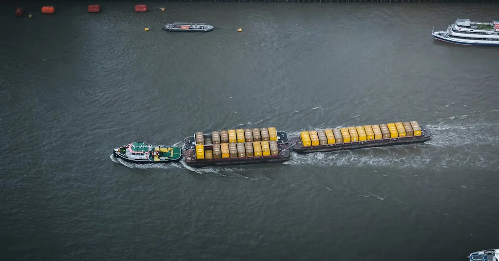
Maritime navigation routes and shipping lanes near the UK are crucial pathways for international trade, connecting the North Sea, English Channel, and Atlantic Ocean. These routes accommodate a high volume of commercial vessels, including cargo ships, tankers, and ferries. The area is known for its dense traffic, strict regulations, and advanced navigational aids to ensure safety. Major ports like London, Southampton, and Liverpool rely on these established lanes for efficient maritime operations.
Maritime navigation routes and shipping lanes near the UK
Maritime navigation routes and shipping lanes near the UK are crucial pathways for international trade, connecting the North Sea, English Channel, and Atlantic Ocean. These routes accommodate a high volume of commercial vessels, including cargo ships, tankers, and ferries. The area is known for its dense traffic, strict regulations, and advanced navigational aids to ensure safety. Major ports like London, Southampton, and Liverpool rely on these established lanes for efficient maritime operations.
💡 Key Takeaways
- Identify the major UK sea lanes that connect the North Sea, English Channel, and Atlantic Ocean.
- Explain how high traffic volumes from cargo ships, tankers, and ferries influence navigation decisions and safety.
- Describe key navigational provisions and management tools used in UK waters (shipping lanes, traffic separation schemes, Vessel Traffic Service, and COLREGs).
- Recognize environmental and safety factors in busy UK waters, including weather, tides, and pollution risks.
❓ Frequently Asked Questions
What are maritime navigation routes near the UK?
Designated sea lanes that organize ship traffic through busy waters such as the North Sea, English Channel, and approaches to the Atlantic, helping prevent collisions and improve efficiency.
What is a Traffic Separation Scheme (TSS) and why is it used near the UK?
An IMO-approved route that separates opposing traffic flows to reduce collision risk, commonly applied in busy areas like the Dover Strait and other English Channel routes.
Which vessels typically use these routes?
Cargo ships, container ships, tankers, ferries, and other commercial vessels.
What tools and rules help ships navigate these lanes safely?
Vessel Traffic Services (VTS) monitor traffic; ships use AIS and radar; crews follow COLREGs and designated lanes, speeds, and reporting procedures.
What is a major geographic feature or chokepoint in UK waters?
The Dover Strait (Strait of Dover) is a busy chokepoint linking the North Sea and English Channel, with heavy ferry and cargo traffic.