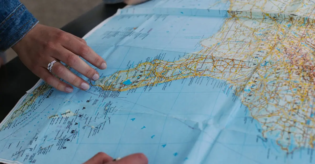
Navigation with map, compass, and GPS involves using traditional and modern tools to determine your location and plan routes. A map provides a visual representation of the terrain, while a compass helps you find direction relative to magnetic north. GPS devices use satellite signals to pinpoint your exact position. Combining these tools enhances accuracy, safety, and confidence when traveling through unfamiliar areas, ensuring you can orient yourself and reach your destination efficiently.
Navigation with Map, Compass, GPS
Navigation with map, compass, and GPS involves using traditional and modern tools to determine your location and plan routes. A map provides a visual representation of the terrain, while a compass helps you find direction relative to magnetic north. GPS devices use satellite signals to pinpoint your exact position. Combining these tools enhances accuracy, safety, and confidence when traveling through unfamiliar areas, ensuring you can orient yourself and reach your destination efficiently.
💡 Key Takeaways
- Read a map by understanding scale, legend, and terrain features to estimate distances and plan routes.
- Use a compass to determine bearings, align with magnetic north, and navigate in the chosen direction.
- Understand GPS basics—satellite signals, coordinates, and following routes with waypoints and ETA.
- Combine map, compass, and GPS skills to navigate safely and adapt to changing conditions in adventure settings.
❓ Frequently Asked Questions
What role does a map play in navigation?
A map shows terrain, features, and routes, helping you plan where to go and estimate distances.
How does a compass help you find direction in the wild?
A compass points to magnetic north; you read bearings and align them with your intended route and landmarks.
What is GPS and how does it determine your location?
GPS uses satellites to calculate your position on Earth; it works best with a clear sky but relies on a powered device.
How should you use map, compass, and GPS together in the field?
Plan and navigate with the map and compass; use GPS to confirm your position when possible; be prepared to rely on traditional tools if GPS fails.
What is magnetic declination and why adjust bearings?
Magnetic declination is the difference between magnetic north and true north; adjust compass bearings by the declination to match your map.