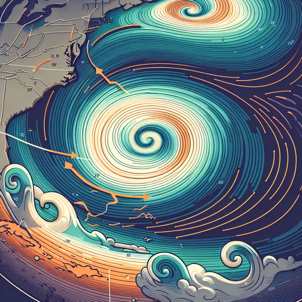
Synoptic meteorology focuses on large-scale atmospheric patterns and processes. Cyclogenesis refers to the development or intensification of cyclonic systems, such as low-pressure weather systems. This process involves the interaction of air masses, temperature gradients, and upper-level atmospheric dynamics, leading to the formation of storms and significant weather events. Understanding cyclogenesis is vital for predicting severe weather, as it helps meteorologists track storm evolution and anticipate impacts on regional and global weather patterns.
Synoptic Meteorology: Cyclogenesis
Synoptic meteorology focuses on large-scale atmospheric patterns and processes. Cyclogenesis refers to the development or intensification of cyclonic systems, such as low-pressure weather systems. This process involves the interaction of air masses, temperature gradients, and upper-level atmospheric dynamics, leading to the formation of storms and significant weather events. Understanding cyclogenesis is vital for predicting severe weather, as it helps meteorologists track storm evolution and anticipate impacts on regional and global weather patterns.
💡 Key Takeaways
- Understand the stages and mechanisms of cyclogenesis, including how a surface low-pressure system forms and intensifies.
- Explain how interactions between contrasting air masses and horizontal temperature gradients drive cyclogenesis.
- Describe the role of upper-level dynamics—such as jet streams, troughs, and vorticity advection—in initiating and steering cyclones.
- Identify common synoptic indicators used to diagnose cyclogenesis, including falling sea-level pressure, fronts, and evolving occlusion.
❓ Frequently Asked Questions
What is cyclogenesis?
Cyclogenesis is the development or intensification of a cyclonic (low‑pressure) weather system, typically a mid‑latitude cyclone, driven by interactions of air masses, temperature gradients, and upper‑level atmospheric dynamics.
What mechanisms drive cyclogenesis in synoptic-scale weather?
Key drivers include lifting and surface convergence where contrasting air masses meet (fronts), baroclinic instability from strong temperature gradients, and upper‑level divergence from features like the jet stream that lower surface pressure and intensify the cyclone.
What role do fronts and the jet stream play in cyclogenesis?
Fronts organize lifting and convergence that help a low form, while the jet stream provides upper‑level divergence and vorticity advection that accelerate development and deepening of the cyclone.
How can you recognize a developing cyclone on weather maps?
Look for a central pressure minimum with tightening isobars, the appearance or strengthening of warm and cold fronts, increasing wind, and precipitation concentrated along the fronts.