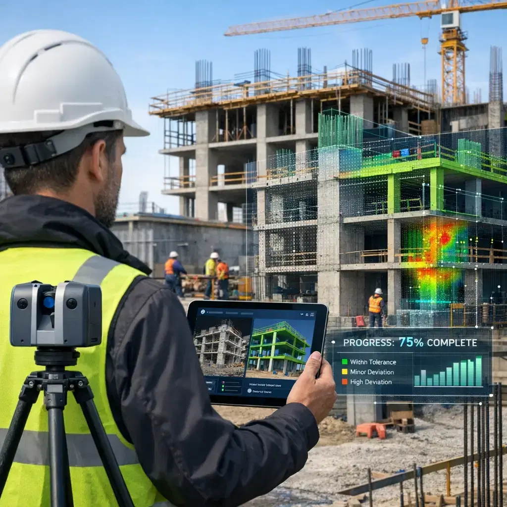
Reality Capture for Progress Monitoring (CV) utilizes computer vision technologies to collect and analyze visual data from construction sites. Through digital applications, images and 3D scans are processed to track project progress, compare actual conditions with design models, and identify discrepancies in real time. This approach enhances construction information management by enabling accurate, up-to-date documentation, improving decision-making, and increasing efficiency throughout the project lifecycle.
Reality Capture for Progress Monitoring (CV)
Reality Capture for Progress Monitoring (CV) utilizes computer vision technologies to collect and analyze visual data from construction sites. Through digital applications, images and 3D scans are processed to track project progress, compare actual conditions with design models, and identify discrepancies in real time. This approach enhances construction information management by enabling accurate, up-to-date documentation, improving decision-making, and increasing efficiency throughout the project lifecycle.
💡 Key Takeaways
- Understand how reality capture turns photos and scans into 3D models, point clouds, and meshes for progress monitoring.
- Learn how to compare current captures with the design model to measure progress and detect deviations.
- Discover best practices for data capture (planning flights or shots, overlap, lighting, calibration) to ensure accurate results.
- Learn to extract and visualize progress metrics such as completion percentage, volume changes, and area differences over time.
❓ Frequently Asked Questions
What is reality capture for progress monitoring?
Reality capture creates accurate digital representations (point clouds, meshes, 3D models) of a real site using sensors like cameras, LiDAR, and drones to document current conditions and compare them to plans.
What tools and data sources are commonly used?
Common sources include drone or ground imagery for photogrammetry, LiDAR scans, and handheld scanners; software performs structure-from-motion, SLAM, and meshing to produce 3D models and maps.
How is progress measured with reality capture?
New captures are aligned with baselines or BIM, then deltas such as volume changes, surface deviations, or completion percentages are computed to assess progress.
What are best practices and common challenges?
Use consistent data collection (same locations, overlap, lighting), ensure proper georeferencing and data quality checks, and be mindful of privacy and safety; validate results before decisions.