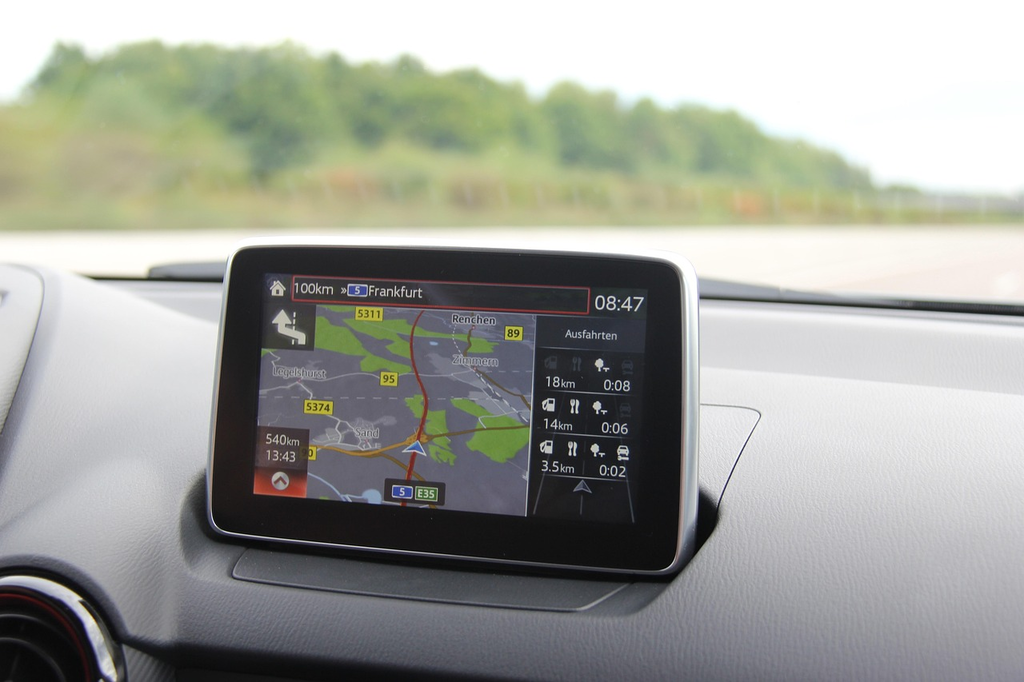
Car navigation systems are electronic devices or software integrated into vehicles to assist drivers in reaching their destinations efficiently. Using GPS technology, these systems provide real-time directions, traffic updates, and route suggestions. In cars, they display maps and voice-guided instructions, while in planes, advanced navigation aids pilots with flight paths and coordinates. These systems enhance safety, save time, and improve overall travel experiences for both drivers and pilots.
Car Navigation Systems
Car navigation systems are electronic devices or software integrated into vehicles to assist drivers in reaching their destinations efficiently. Using GPS technology, these systems provide real-time directions, traffic updates, and route suggestions. In cars, they display maps and voice-guided instructions, while in planes, advanced navigation aids pilots with flight paths and coordinates. These systems enhance safety, save time, and improve overall travel experiences for both drivers and pilots.
💡 Key Takeaways
- Understand how car navigation systems calculate routes and choose between fastest and shortest paths.
- Learn how live traffic updates, road closures, and map revisions affect routing decisions.
- Identify common features such as voice guidance, lane assist, turn-by-turn directions, and points of interest.
- Differentiate between offline (preloaded) and online (cloud-connected) navigation and when each is useful.
❓ Frequently Asked Questions
What is a car navigation system?
A device (built-in or aftermarket) that uses digital maps and satellite positioning to plan routes, show turn‑by‑turn directions, and estimate arrival times.
How does a navigation system determine your location?
It uses GNSS signals (such as GPS, GLONASS, Galileo, or BeiDou) and may combine them with vehicle sensors to pinpoint position and track movement.
What is the difference between offline maps and online navigation?
Offline maps are stored on the device and work without internet, while online navigation uses real-time data (traffic, updates) but requires connectivity.
How does route calculation work and what can influence it?
Routes are computed based on factors like distance, time, and user preferences (e.g., avoid tolls). Real-time traffic, closures, and restrictions can cause automatic rerouting.